.synthesis { max-width: 640px; margin: 2em auto; padding: 1.5em 1.8em; color: #78350f; font-family: “Inter”, “Segoe UI”, sans-serif; text-align: left; position: relative; box-sizing: border-box; background: #fffaf0; border: 1px solid #b45309; border-left: 6px solid #b45309; border-radius: 8px; box-shadow: 0 8px 24px rgba(251, 191, 36, 0.15); }
.synthesis h2, .synthesis .synthesis-header { font-size: 1.15em; font-weight: 700; margin-bottom: 0.6em; color: #b45309; }
.synthesis p, .synthesis li { font-size: 1em; line-height: 1.65; margin: 10px; }
.synthesis strong { color: #451a03; }
.synthesis table { width: 100%; border-collapse: collapse; }
.synthesis th { background: rgba(180, 83, 9, 0.12); color: #b45309; text-align: left; }
.synthesis td, .synthesis th { padding: 8px 12px; border-bottom: 1px solid rgba(180, 83, 9, 0.18); vertical-align: top; }
.synthesis tbody tr:nth-child(even) { background: rgba(180, 83, 9, 0.05); }
.key-takeaways { max-width: 640px; margin: 2em auto; padding: 1.5em 1.8em; color: #78350f; font-family: “Inter”, “Segoe UI”, sans-serif; text-align: left; position: relative; box-sizing: border-box; background: #fffaf0; border: 1px solid #b45309; border-left: 6px solid #b45309; border-radius: 8px; box-shadow: 0 8px 24px rgba(251, 191, 36, 0.15); }
.key-takeaways h2, .key-takeaways .key-takeaways-header { font-size: 1.15em; font-weight: 700; margin-bottom: 0.6em; color: #b45309; }
.key-takeaways p, .key-takeaways li { font-size: 1em; line-height: 1.65; margin: 10px; }
.key-takeaways strong { color: #451a03; }
.key-takeaways ul { list-style: none; padding-left: 0; }
.key-takeaways li { margin: 0.45em 0; padding-left: 0.2em; }
.mg-callout{margin:1.5em 0;padding:.9em 1.1em;border:1px solid;border-left-width:4px;border-radius:10px;font-size:.97em;line-height:1.65}.mg-callout>:first-child{margin-top:0}.mg-callout>:last-child{margin-bottom:0}.mg-callout__label{display:block;margin:0 0 .35em;font-weight:700;font-size:.82em;letter-spacing:.03em;text-transform:uppercase}.mg-callout__label::before{margin-right:.45em;font-size:1.05em;vertical-align:-.06em}.mg-callout–info{background:#eff6ff;border-color:#bfdbfe;color:#1e3a5f}.mg-callout–info .mg-callout__label{color:#2563eb}.mg-callout–info .mg-callout__label::before{content:”\2139\FE0F”}.mg-callout–tip{background:#f0fdf4;border-color:#bbf7d0;color:#14532d}.mg-callout–tip .mg-callout__label{color:#15803d}.mg-callout–tip .mg-callout__label::before{content:”\1F4A1″}.mg-callout–warning{background:#fffbeb;border-color:#fde68a;color:#7a4a10}.mg-callout–warning .mg-callout__label{color:#b45309}.mg-callout–warning .mg-callout__label::before{content:”\26A0\FE0F”}.mg-callout–danger{background:#fef2f2;border-color:#fecaca;color:#7f1d1d}.mg-callout–danger .mg-callout__label{color:#dc2626}.mg-callout–danger .mg-callout__label::before{content:”\1F6D1″}.mg-proscons{display:grid;grid-template-columns:1fr 1fr;gap:16px;margin:1.5em 0}@media(max-width:560px){.mg-proscons{grid-template-columns:1fr}}.mg-proscons__col{padding:.9em 1.1em;border:1px solid;border-radius:10px}.mg-proscons__title{display:flex;align-items:center;gap:.4em;margin:0 0 .5em;font-weight:700;font-size:.9em;letter-spacing:.02em}.mg-proscons__col ul{margin:.3em 0 0;padding-left:1.15em}.mg-proscons__col li{margin:.3em 0;line-height:1.55}.mg-proscons__col–pro{background:#f0fdf4;border-color:#bbf7d0;color:#14532d}.mg-proscons__col–pro .mg-proscons__title{color:#15803d}.mg-proscons__col–pro .mg-proscons__title::before{content:”\2705″}.mg-proscons__col–con{background:#fef2f2;border-color:#fecaca;color:#7f1d1d}.mg-proscons__col–con .mg-proscons__title{color:#dc2626}.mg-proscons__col–con .mg-proscons__title::before{content:”\274C”}ol.mg-steps{list-style:none!important;counter-reset:mgstep;margin:1.6em 0;padding-left:0!important}ol.mg-steps>li.mg-steps__item{counter-increment:mgstep;list-style:none!important;padding-left:0!important;padding-bottom:1.4em}ol.mg-steps>li.mg-steps__item:last-child{padding-bottom:0}ol.mg-steps>li.mg-steps__item>:last-child{margin-bottom:0}ol.mg-steps>li.mg-steps__item>.mg-steps__title{margin:0 0 .25em;font-weight:600}ol.mg-steps>li.mg-steps__item>.mg-steps__title::before{content:counter(mgstep) “. “;opacity:.45;font-weight:500;font-variant-numeric:tabular-nums}ol.mg-steps>li.mg-steps__item:not(:has(.mg-steps__title))::before{content:counter(mgstep) “. “;opacity:.45;font-weight:500;font-variant-numeric:tabular-nums}.mg-kpis{display:grid;grid-template-columns:repeat(auto-fit,minmax(140px,1fr));gap:14px;margin:1.5em 0}.mg-kpi{padding:1em .9em;border:1px solid #e5e7eb;border-radius:12px;background:#f9fafb;text-align:center}.mg-kpi__value{display:block;font-size:1.7em;font-weight:800;line-height:1.15;color:#111827}.mg-kpi__label{display:block;margin-top:.35em;font-size:.85em;color:#6b7280;line-height:1.35}
.wp-block-image,.ai-image{margin-bottom:1.75em}.wp-block-image>figcaption,.ai-image>figcaption{margin-top:.5em}
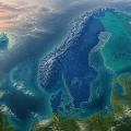
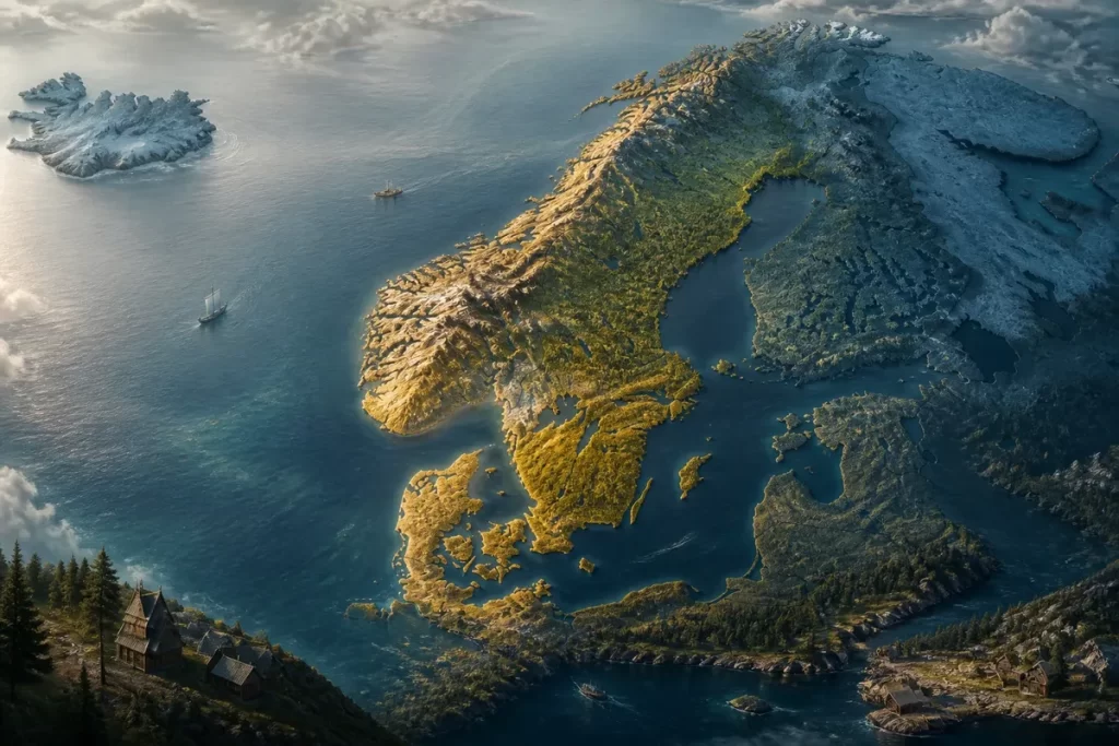
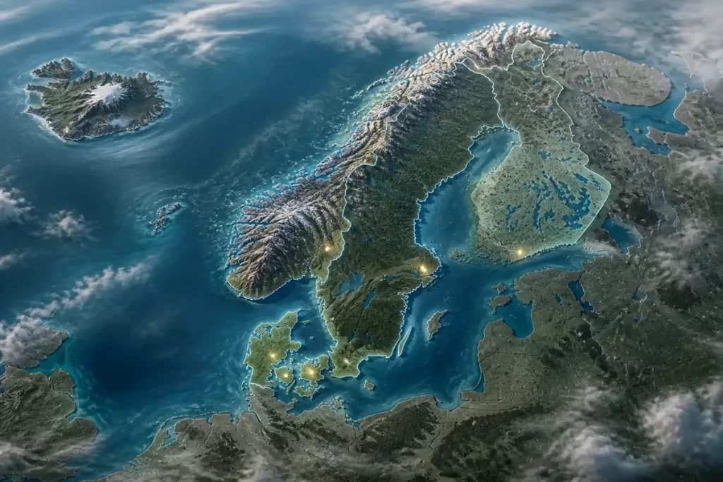
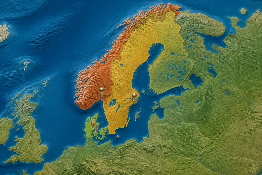
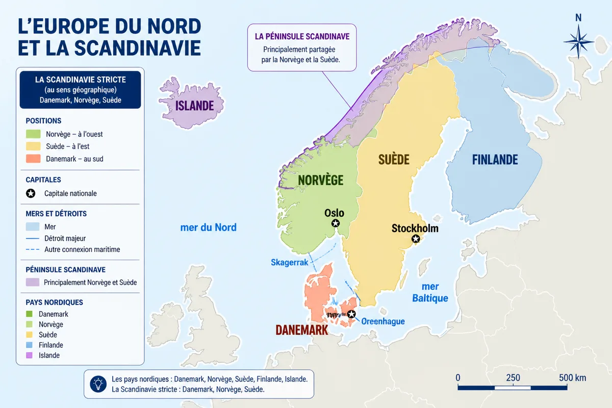
Three countries make up Scandinavia in the strict sense: Denmark, Norway, and Sweden. A map of the Scandinavian countries places them in Northern Europe, with Norway to the west, Sweden to the east, and Denmark to the south, between the North Sea and the Baltic Sea.

Finland and Iceland are often associated with this region, but they more broadly belong to the Nordic countries. To read a map without confusion, it is therefore necessary to distinguish the cultural perimeter of Scandinavia, the Scandinavian Peninsula, and the broader Nordic political entity.
| 🗺️ | Strict Scandinavia: Denmark, Norway, and Sweden. |
| 📍 | Position: Norway to the west, Sweden to the east, Denmark to the south. |
| 🏛️ | Capitals: Copenhagen, Oslo, and Stockholm. |
| 🌊 | Seas and straits: North Sea, Baltic Sea, Skagerrak, Kattegat, and Øresund. |
| 🧭 | Scandinavian Peninsula: mainly occupied by Norway and Sweden. |
| 🌐 | Nordic countries: a broader group also including Finland and Iceland. |
Where to locate the Scandinavian countries on a map of Northern Europe?
On a map of Northern Europe, Norway occupies the western side of the peninsula, Sweden extends along its eastern slope, and Denmark closes the space to the south. The capitals appear in the southern half, while the Norwegian and Swedish territories extend far to the north.

The term Scandinavia here refers to a historical and cultural region, not a single administrative boundary. This distinction explains why some maps add Finland or Iceland: they then represent the Nordic countries, whose perimeter is broader.
Geographical landmarks visible on the map
The North Sea borders the western coast of Denmark and meets the Atlantic waters near Norway. To the east, the Baltic Sea accompanies Sweden, while the Skagerrak and Kattegat organize the maritime passages between Denmark, Norway, and Sweden.
The Scandinavian Peninsula forms a long landmass oriented from southwest to northeast. It is mainly occupied by Norway and Sweden. The mountain range that follows their border reinforces this reading of the map.
- West: Atlantic Ocean and Norwegian Sea, with a very rugged Norwegian coast.
- East: Baltic Sea and Gulf of Bothnia along Sweden.
- South: Jutland, Danish straits, and access to continental Europe.
- North: extension of Norwegian and Swedish territories towards the Arctic regions.
A map intended for learning must display these landmarks with a readable legend, as colors alone are not enough when land borders and maritime boundaries are close.
Which countries make up Scandinavia and where are they located?
The Scandinavian map in the strict sense is based on three states: Denmark, Norway, and Sweden. Norway and Sweden occupy most of the peninsula, while Denmark is located to the south, between continental Jutland and a group of islands.
Norway: the western coast
Norway stretches along the Atlantic and the Norwegian Sea, from the Skagerrak to the extreme north of Europe. Oslo is located in the southeast of the country, at the end of the Oslofjord, far from the western coast known for its fjords.
On site, this geography strongly changes perceived distances: two places close as the crow flies can be separated by a fjord, a mountain, or a road that goes around the relief. The eastern border meets Sweden, Finland, and Russia.
Norway is therefore better understood with two simultaneous pieces of information: its position on the Atlantic edge and its very long extension to the north. A map that reduces the country to Oslo and the southern fjords gives an incomplete vision.
Sweden: the eastern side of the peninsula
Sweden occupies the largest eastern part of the Scandinavian Peninsula, between Norway to the west and the Baltic Sea to the east. Stockholm is located on the eastern coast, in an environment of islands and channels facing the Baltic.
Sweden shares a land border with Norway to the west and with Finland to the northeast. Its territory extends southward on the peninsula, then opens widely onto the Baltic.

Denmark: the southern area
Denmark is located south of Scandinavia, with Jutland connected to the European continent and several major islands, including Zealand and Funen. Copenhagen is situated on Zealand, facing Sweden and in close proximity to the Øresund.


Jutland extends the European continent northward, while the Danish islands structure the passages toward Sweden. This configuration explains why Denmark sometimes appears detached from the Scandinavian peninsula on physical maps.

Denmark therefore fits into a political map of Scandinavia, even though its main territory is not located on the geographic peninsula of the same name. In this case, do not remove it from the legend.
What borders and seas appear on the map?
Land borders directly connect Norway to Sweden, Finland, and Russia; Sweden to Norway and Finland; and Denmark to Germany. The seas and straits separate the territories while organizing their exchanges.
Land Borders and Reliefs
The Norway-Sweden border follows much of the Scandinavian mountain range. Further north, the border between Sweden and Finland notably follows the course of the Torne River, while the Danish border with Germany is located in southern Jutland.
On site, a border visible on a map does not necessarily mean a clear break in the landscape or movement. Roads, ferries, and bridges cross this area along very different routes, especially around the Danish straits.
- Continuous line: international land border.
- Colored area: territory included within the chosen perimeter.
- Maritime line: separation or boundary indicated by the map, to be read with its legend.
- Point symbol: capital, port, or other geographical landmark.
Seas, Straits, and Maritime Borders
The Skagerrak lies between Norway and Denmark, while the Kattegat extends between Denmark and Sweden. The Øresund forms the narrowest passage between Danish Zealand and Swedish Scania.
A simplified map may color the sea without representing a legally detailed maritime border. To know a precise delimitation, one must consult an official map adapted to maritime law and the desired scale.
The Baltic Sea mainly borders Sweden and Denmark to the east. The North Sea accompanies western Jutland and maritime access routes to Norway.
Projection, Associated Territories, and Date of the Map
A cartographic projection always distorts at least one property: areas, distances, angles, or shapes. The further a map is from its central zone, the more visual comparisons between Norway, Sweden, and Denmark should be made with caution.
Territories associated with certain states may benefit from particular political or administrative autonomy without becoming independent sovereign states. Their presence on a map therefore depends on the definition retained and the territorial level represented.
Before using a map for an assignment or a trip, look at its legend, scale, and update date. The borders shown must be verified in an official geographic source when the issue goes beyond simple location.
What are the capitals of the Scandinavian countries?
| Country | Capital | Position on the map | Maritime landmark |
|---|---|---|---|
| Denmark | Copenhagen | Island of Zealand, in the east of the country | Øresund and Baltic Sea |
| Norway | Oslo | Southeast of the territory | Oslofjord and Skagerrak |
| Sweden | Stockholm | Eastern coast | Archipelago and Baltic Sea |
The position of the capitals tells part of the historical organization of the region: they developed near coasts, fjords, or straits favorable to trade. Stockholm faces the Baltic, Oslo its fjord, and Copenhagen the Danish maritime passages.

The most frequent confusion comes from the automatic addition of Finland and Iceland on a map announced as Scandinavian. To compare the perimeters, also consult this presentation of the Scandinavian and Nordic countries, which separates the two usages.
An expanded map can then add the Nordic countries, with Helsinki for Finland and Reykjavik for Iceland, without changing the location of the three central Scandinavian countries. This extension corresponds to another geographical intention.
To memorize quickly, start from the south: Copenhagen in Denmark, Oslo in the southeast of Norway, then Stockholm on the eastern Swedish coast. On a blank map, these three points are enough to reconstruct the framework of the region.
.magic-lb-overlay{position:fixed;inset:0;background:rgba(15,23,42,.92);display:none;align-items:center;justify-content:center;z-index:99999;cursor:zoom-out;padding:20px}
.magic-lb-overlay.open{display:flex}
.magic-lb-overlay img{max-width:95vw;max-height:95vh;object-fit:contain;border-radius:8px;box-shadow:0 8px 32px rgba(0,0,0,.5)}
.magic-lb-close{position:absolute;top:16px;right:20px;color:#fff;background:rgba(0,0,0,.5);border:none;width:40px;height:40px;border-radius:50%;font-size:24px;cursor:pointer;display:flex;align-items:center;justify-content:center}
.magic-lb-close:hover{background:rgba(0,0,0,.8)}
.wp-block-image img{cursor:zoom-in;transition:transform .15s ease}
.wp-block-image img:hover{transform:scale(1.01)}
.magic-img-link{display:inline-block;text-decoration:none}
(function(){
var ov=document.getElementById(‘magic-lb’);if(!ov)return;
var img=ov.querySelector(‘img’),btn=ov.querySelector(‘.magic-lb-close’);
var L={fr:’Fermer’,es:’Cerrar’,en:’Close’,pt:’Fechar’,it:’Chiudi’,de:’Schlie\u00dfen’,nl:’Sluiten’,ca:’Tancar’};
btn.setAttribute(‘aria-label’,L[(document.documentElement.lang||”).slice(0,2).toLowerCase()]||’Close’);
function open(src){img.src=src;ov.classList.add(‘open’);document.body.style.overflow=’hidden’}
function close(){ov.classList.remove(‘open’);img.src=”;document.body.style.overflow=”}
document.addEventListener(‘click’,function(e){
var a=e.target.closest(‘a.magic-img-link’);
if(a){e.preventDefault();open(a.getAttribute(‘href’));return}
var i=e.target.closest(‘.wp-block-image img’);
if(i&&!e.target.closest(‘a’)){e.preventDefault();open(i.currentSrc||i.src)}
});
ov.addEventListener(‘click’,function(e){if(e.target===ov||e.target===btn)close()});
document.addEventListener(‘keydown’,function(e){if(e.key===’Escape’)close()});
})();